Sunday, February 22, 2009

PYRAMID


A pyramid is a building where the outer surfaces are triangular and converge at a point. The base of pyramids are usually quadrilateral or trilateral (but may be of any polygon shape), meaning that a pyramid usually has four or five faces. A pyramid's design, with the majority of the weight closer to the ground, means that less material higher up on the pyramid will be pushing down from above: this allowed early civilizations to create stable monumental structures.

For thousands of years, the largest structures on Earth were pyramids: first the Red Pyramid in the Dashur Necropolis and then the Great Pyramid of Khufu, the only one of the Seven Wonders of the Ancient World still remaining. The largest pyramid ever built, by volume, is the Great Pyramid of Cholula, in the Mexican state of Puebla. This pyramid is still being excavated.


A pyramid scheme is a non-sustainable business model that involves the exchange of money primarily for enrolling other people into the scheme, often without any product or service being delivered.

Pyramid schemes are illegal in many countries, including the United States[1], the United Kingdom, France, Germany, Canada, Romania[2], Colombia[3], Malaysia, Norway, Bulgaria, Australia[4], New Zealand[5], Japan[6], Nepal[citation needed], Philippines[7], South Africa[8], Sri Lanka[9], Thailand[10], Iran[citation needed], and the People's Republic of China


Wednesday, February 18, 2009

BUET


Bangladesh University of Engineering and Technology, abbreviated as BUET, is one of the most prestigious institutions for higher studies in the country. About 5500 students are pursuing undergraduate and postgradute studies in engineering, architecture, planning and science in this institution. At present, BUET has sixteen teaching departments under five faculties and it has three institutes. Every year the intake of undergraduate students is around 900, while the intake of graduate students in Masters and PhD programs is around 1000. A total of about five hundred teachers are teaching in these departments and institutes. There are additional teaching posts like Dr. Rashid Professor, Professor Emeritus and Supernumerary Professors.

The BUET campus is in the heart of Dhaka - the capital city of Bangladesh. It has a compact campus with halls of residence within walking distances of the academic buildings. The physical expansion of the University over the last three decades has been impressive with construction of new academic buildings, auditorium complex, halls of residence, etc.

BUET is the oldest institution for the study of Engineering and Architecture in Bangladesh. The history of this institution dates back to the days of Dhaka Survey School which was established at Nalgola, in Old Dhaka in 1876 to train Surveyors for the then Government of Bengal of British India. As the years passed, the Survey School became the Ahsanullah School of Engineering offering three-year diploma courses in Civil, Electrical and Mechanical Engineering. In recognition of the generous financial contribution from the then Nawab of Dhaka, it was named after his father Khawja Ahsanullah. It moved to its present premises in 1912. In 1947, the School was upgraded to Ahsanullah Engineering College as a Faculty of Engineering under the University of Dhaka, offering four-year bachelor’s courses in Civil, Electrical, Mechanical, Chemical and Metallurgical Engineering. In order to create facilities for postgraduate studies and research, Ahsanullah Engineering College was upgraded to the status of a University in 1962 and was named East Pakistan University of Engineering and Technology. After the war of Liberation in 1971, Bangladesh became an independent state and the university was renamed as the Bangladesh University of Engineering and Technology.

Till today, it has produced around 25,000 graduates in different branches of engineering and architecture, and has established a good reputation all over the world for the quality of its graduates, many of whom have excelled in their profession in different parts of the globe. It was able to attract students from countries like India, Nepal, Iran, Jordan, Malaysia, Sri Lanka, Pakistan and Palestine.

Both Undergraduate and Postgraduate studies and research are now among the primary functions of the University. Eleven departments under five faculties offer Bachelor Degrees, while most of the departments and institutes offer Masters Degrees and some of the departments have Ph.D. programs. In addition to its own research programs, the university undertakes research programs sponsored by outside organizations like European Union, UNO, Commonwealth, UGC, etc. The expertise of the University teachers and the laboratory facilities of the University are also utilized to solve problems and to provide up-to-date engineering and technological knowledge to the various organizations of the country.

World Climate

World Climate Zones

Have you ever wondered why one area of the world is a desert, another a grassland, and another a rainforest? Why are there different forests and deserts, and why are there different types of life in each area? The answer is climate.

Climate is the characteristic condition of the atmosphere near the earth's surface at a certain place on earth. It is the long-term weather of that area (at least 30 years). This includes the region's general pattern of weather conditions, seasons and weather extremes like hurricanes, droughts, or rainy periods. Two of the most important factors determining an area's climate are air temperature and precipitation.

World biomes are controlled by climate. The climate of a region will determine what plants will grow there, and what animals will inhabit it. All three components, climate, plants and animals are interwoven to create the fabric of a biome.


Some facts about climate

The sun's rays hit the equator at a direct angle between 23 ° N and 23 ° S latitude. Radiation that reaches the atmosphere here is at its most intense.

In all other cases, the rays arrive at an angle to the surface and are less intense. The closer a place is to the poles, the smaller the angle and therefore the less intense the radiation.

Our climate system is based on the location of these hot and cold air-mass regions and the atmospheric circulation created by trade winds and westerlies.

Trade winds north of the equator blow from the northeast. South of the equator, they blow from the southeast. The trade winds of the two hemispheres meet near the equator, causing the air to rise. As the rising air cools, clouds and rain develop. The resulting bands of cloudy and rainy weather near the equator create tropical conditions.

Westerlies blow from the southwest on the Northern Hemisphere and from the northwest in the Southern Hemisphere. Westerlies steer storms from west to east across middle latitudes.

Both westerlies and trade winds blow away from the 30 ° latitude belt. Over large areas centered at 30 ° latitude, surface winds are light. Air slowly descends to replace the air that blows away. Any moisture the air contains evaporates in the intense heat. The tropical deserts, such as the Sahara of Africa and the Sonoran of Mexico, exist under these regions.

Köppen Climate Classification System

The Köppen Climate Classification System is the most widely used for classifying the world's climates. Most classification systems used today are based on the one introduced in 1900 by the Russian-German climatologist Wladimir Köppen. Köppen divided the Earth's surface into climatic regions that generally coincided with world patterns of vegetation and soils.

The Köppen system recognizes five major climate types based on the annual and monthly averages of temperature and precipitation. Each type is designated by a capital letter.

A - Moist Tropical Climates are known for their high temperatures year round and for their large amount of year round rain.

B - Dry Climates are characterized by little rain and a huge daily temperature range. Two subgroups, S - semiarid or steppe, and W - arid or desert, are used with the B climates.

C - In Humid Middle Latitude Climates land/water differences play a large part. These climates have warm,dry summers and cool, wet winters.

D - Continental Climates can be found in the interior regions of large land masses. Total precipitation is not very high and seasonal temperatures vary widely.

E - Cold Climates describe this climate type perfectly. These climates are part of areas where permanent ice and tundra are always present. Only about four months of the year have above freezing temperatures.

Further subgroups are designated by a second, lower case letter which distinguish specific seasonal characteristics of temperature and precipitation.

f - Moist with adequate precipitation in all months and no dry season. This letter usually accompanies the A, C, and D climates.

m - Rainforest climate in spite of short, dry season in monsoon type cycle. This letter only applies to A climates.

s - There is a dry season in the summer of the respective hemisphere (high-sun season).

w - There is a dry season in the winter of the respective hemisphere (low-sun season).

To further denote variations in climate, a third letter was added to the code.

a - Hot summers where the warmest month is over 22°C (72°F). These can be found in C and D climates.

b - Warm summer with the warmest month below 22°C (72°F). These can also be found in C and D climates.

c - Cool, short summers with less than four months over 10°C (50°F) in the C and D climates.

d - Very cold winters with the coldest month below -38°C (-36°F) in the D climate only.

h - Dry-hot with a mean annual temperature over 18°C (64°F) in B climates only.

k - Dry-cold with a mean annual temperature under 18°C (64°F) in B climates only.


Three basic climate groups.
Three major climate groups show the dominance of special combinations of air-mass source regions.

Group I

Low-latitude Climates: These climates are controlled by equatorial a tropical air masses.


  • Tropical Moist Climates (Af) rainforest

    Rainfall is heavy in all months. The total annual rainfall is often more than 250 cm. (100 in.). There are seasonal differences in monthly rainfall but temperatures of 27°C (80°F) mostly stay the same. Humidity is between 77 and 88%.

    High surface heat and humidity cause cumulus clouds to form early in the afternoons almost every day.

    The climate on eastern sides of continents are influenced by maritime tropical air masses. These air masses flow out from the moist western sides of oceanic high-pressure cells, and bring lots of summer rainfall. The summers are warm and very humid. It also rains a lot in the winter

    • Average temperature: 18 °C (°F)
    • Annual Precipitation: 262 cm. (103 in.)
    • Latitude Range: 10° S to 25 ° N
    • Global Position: Amazon Basin; Congo Basin of equatorial Africa; East Indies, from Sumatra to New Guinea.

  • Wet-Dry Tropical Climates (Aw) savanna

    A seasonal change occurs between wet tropical air masses and dry tropical air masses. As a result, there is a very wet season and a very dry season. Trade winds dominate during the dry season. It gets a little cooler during this dry season but will become very hot just before the wet season.

    • Temperature Range: 16 °C
    • Annual Precipitation: 0.25 cm. (0.1 in.). All months less than 0.25 cm. (0.1 in.)
    • Latitude Range: 15 ° to 25 ° N and S
    • Global Range: India, Indochina, West Africa, southern Africa, South America and the north coast of Australia

  • Dry Tropical Climate (BW) desert biome

    These desert climates are found in low-latitude deserts approximately between 18° to 28° in both hemispheres. these latitude belts are centered on the tropics of Cancer and Capricorn, which lie just north and south of the equator. They coincide with the edge of the equatorial subtropical high pressure belt and trade winds. Winds are light, which allows for the evaporation of moisture in the intense heat. They generally flow downward so the area is seldom penetrated by air masses that produce rain. This makes for a very dry heat. The dry arid desert is a true desert climate, and covers 12 % of the Earth's land surface.

    • Temperature Range: 16° C
    • Annual Precipitation: 0.25 cm (0.1 in). All months less than 0.25 cm (0.1 in).
    • Latitude Range: 15° - 25° N and S.
    • Global Range: southwestern United States and northern Mexico; Argentina; north Africa; south Africa; central part of Australia.

Group II

  • Mid-latitude Climates: Climates in this zone are affected by two different air-masses. The tropical air-masses are moving towards the poles and the polar air-masses are moving towards the equator. These two air masses are in constant conflict. Either air mass may dominate the area, but neither has exclusive control.


  • Dry Midlatitude Climates (BS) steppe

    Characterized by grasslands, this is a semiarid climate. It can be found between the desert climate (BW) and more humid climates of the A, C, and D groups. If it received less rain, the steppe would be classified as an arid desert. With more rain, it would be classified as a tallgrass prairie.

    This dry climate exists in the interior regions of the North American and Eurasian continents. Moist ocean air masses are blocked by mountain ranges to the west and south. These mountain ranges also trap polar air in winter, making winters very cold. Summers are warm to hot.

    • Temperature Range: 24° C (43° F).
    • Annual Precipitation: less than 10 cm (4 in) in the driest regions to 50 cm (20 in) in the moister steppes.
    • Latitude Range: 35° - 55° N.
    • Global Range: Western North America (Great Basin, Columbia Plateau, Great Plains); Eurasian interior, from steppes of eastern Europe to the Gobi Desert and North China.

  • Mediterranean Climate (Cs) chaparral biome

    This is a wet-winter, dry-summer climate. Extremely dry summers are caused by the sinking air of the subtropical highs and may last for up to five months.

    Plants have adapted to the extreme difference in rainfall and temperature between winter and summer seasons. Sclerophyll plants range in formations from forests, to woodland, and scrub. Eucalyptus forests cover most of the chaparral biome in Australia.

    Fires occur frequently in Mediterranean climate zones.

    • Temperature Range: 7 °C (12 °F)
    • Annual Precipitation: 42 cm (17 in).
    • Latitude Range: 30° - 50° N and S
    • Global Position: central and southern California; coastal zones bordering the Mediterranean Sea; coastal Western Australia and South Australia; Chilean coast; Cape Town region of South Africa.

  • Dry Midlatitude Climates (Bs) grasslands biome

    These dry climates are limited to the interiors of North America and Eurasia.

    Ocean air masses are blocked by mountain ranges to the west and south. This allows polar air masses to dominate in winter months. In the summer, a local continental air mass is dominant. A small amount of rain falls during this season.

    Annual temperatures range widely. Summers are warm to hot, but winters are cold.

    • Temperature Range: 31 °C (56°F).
    • Annual Precipitation: 81 cm. (32 in.).
    • Latitude Range: 30° - 55° N and S
    • Global Position: western North America (Great Basin, Columbia Plateau, Great Plains); Eurasian interior.

  • Moist Continental Climate (Cf) Deciduous Forest biome

    This climate is in the polar front zone - the battleground of polar and tropical air masses. Seasonal changes between summer and winter are very large. Daily temperatures also change often. Abundant precipitation falls throughout the year. It is increased in the summer season by invading tropical air masses. Cold winters are caused by polar and arctic masses moving south.

    • Temperature Range: 31 °C (56 ° F)
    • Average Annual Precipitation: 81 cm (32 in).
    • Latitude Range: 30° - 55° N and S (Europe: 45° - 60° N).
    • Global Position: eastern parts of the United States and southern Canada; northern China; Korea; Japan; central and eastern Europe.


Group III

  • High-latitude climates: Polar and arctic air masses dominate these regions. Canada and Siberia are two air-mass sources which fall into this group. A southern hemisphere counterpart to these continental centers does not exist. Air masses of arctic origin meet polar continental air masses along the 60th and 70th parallels.

  • Boreal forest Climate ( Dfc) taiga biome

    This is a continental climate with long, very cold winters, and short, cool summers. This climate is found in the polar air mass region. Very cold air masses from the arctic often move in. The temperature range is larger than any other climate. Precipitation increases during summer months, although annual precipitation is still small.

    Much of the boreal forest climate is considered humid. However, large areas in western Canada and Siberia receive very little precipitation and fall into the subhumid or semiarid climate type.

    • Temperature Range: 41 °C (74 °F), lows; -25 °C (-14 °F), highs; 16 °C (60 °F).
    • Average Annual Precipitation: 31 cm (12 in).
    • Latitude Range: 50° - 70° N and S.
    • Global Position: central and western Alaska; Canada, from the Yukon Territory to Labrador; Eurasia, from northern Europe across all of Siberia to the Pacific Ocean.

  • Tundra Climate (E) tundra biome

    The tundra climate is found along arctic coastal areas. Polar and arctic air masses dominate the tundra climate. The winter season is long and severe. A short, mild season exists, but not a true summer season. Moderating ocean winds keep the temperatures from being as severe as interior regions.

    • Temperature Range: -22 °C to 6 °C (-10 °F to 41 °F).
    • Average Annual Precipitation: 20 cm (8 in).
    • Latitude Range: 60° - 75° N.
    • Global Position: arctic zone of North America; Hudson Bay region; Greenland coast; northern Siberia bordering the Arctic Ocean.

  • Highland Climate (H) Alpine Biome

    Highland climates are cool to cold, found in mountains and high plateaus. Climates change rapidly on mountains, becoming colder the higher the altitude gets. The climate of a highland area is closely related to the climate of the surrounding biome. The highlands have the same seasons and wet and dry periods as the biome they are in.

    Mountain climates are very important to midlatitude biomes. They work as water storage areas. Snow is kept back until spring and summer when it is released slowly as water through melting.

    • Temperature Range: -18 °C to 10 °C (-2 °F to 50°F)
    • Average Annual Precipitation: 23 cm (9 in.)
    • Latitude Range: found all over the world
    • Global Position: Rocky Mountain Range in North America, the Andean mountain range in South America, the Alps in Europe, Mt. Kilimanjaro in Africa, the Himalayans in Tibet, Mt. Fuji in Japan.

Monday, February 2, 2009

Sundarban_ The Natural BeauTy


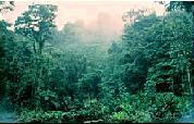
The Sundarbans (Bengali: সুন্দরবন Shundorbôn) is the largest single block of tidal halophytic mangrove forest in the world.[1] "Sundarban" literally means "beautiful jungle" or "beautiful forest" in the Bengali language. The name Sundarbans may also have been derived from the Sundari trees that are found in Sundarbans in large numbers. Other possible explanations can be a derivation from "Samudraban" (Bengali: সমুদ্রবন Shomudrobôn "Sea Forest") or "Chandra-bandhe" (name of a primitive tribe). But the generally accepted view is the one associated with Sundari trees.[1]


The forest lies at the mouth of the Ganges and is spread across areas of Bangladesh and West Bengal, India, forming the seaward fringe of the delta. The seasonally-flooded Sundarbans freshwater swamp forests lie inland from the mangrove forests. The forest covers 10,000 sq.km of which about 6,000 are in Bangladesh.[2] It became inscripted as a UNESCO world heritage site in 1997, but while the Bangladeshi and Indian portions constitute the same continuous ecotope, these are separately listed in the UNESCO world heritage list as the


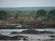
Sundarbans and Sundarbans National Park, respectively. The Sundarbans is intersected by a complex network of tidal waterways, mudflats and small islands of salt-tolerant mangrove forests. The area is known for the eponymous Royal Bengal Tiger, as well as numerous fauna including species of birds, spotted deer, crocodiles and snakes. It is estimated that there are now 500[citation needed] Bengal tigers and about 30,000 spotted deer in the area. Sundarbans was designated a Ramsar site on May 21, 1992. The fertile soils of the delta have been subject to intensive human use for centuries, and the ecoregion has been mostly converted to intensive agriculture, with few enclaves of forest remaining. The remaining forests, together with the Sundarbans mangroves, are important habitat for the endangered tiger (Panthera tigris


History

During the Mughal period (1203-1538), the local kings leased the forests of the Sundarbans out. The history of changes in legal status boasts a number of unique features including the distinction of being the first mangrove forest in the world to be brought under scientific management. The area was mapped by the Surveyor General as early as 1764 following soon after proprietary rights were obtained from the Mughal Emperor, Alamgir II, by the East India Company in 1757. Systematic management of this forest tract started in the 1860s after the establishment of a Forest Department in the Province of Bengal, in India.

The first Forest Management Division to have jurisdiction over the Sundarbans was established in 1869. The Sundarbans was declared a reserved forest in 1875-76, under the Forest Act, 1865 (Act VIII of 1865). The first management plan was written for the period 1893-98.[3][4] In 1875 a large portion of the mangrove forests was declared as reserved forests under the Forest Act, 1865 (Act VIII of 1865). The remaining portions of forests was declared as reserve forest the following year and the forest, which was so far was administered by the civil administration district, was placed under the control of the Forest Department. A Forest Division, which is the basic forest management and administration unit, was created in 1879 with the headquarter in Khulna.


In 1911, it was described as a tract of waste country which had never been surveyed, nor had the census been extended to it. It then stretched for about 165 miles (266 km) from the mouth of the Hugli to the mouth of the Meghna and was bordered inland by the three settled districts of the 24 Parganas, Khulna and Backergunje. The total area (including water) was estimated at 6,526 square miles (16,902 km2). It was a water-logged jungle, in which tigers and other wild beasts abounded. Attempts at reclamation had not been very successful. The characteristic tree was the Sundari (Heritiera littoralis), from which the name of the tract had probably been derived. It yields a hard wood, used for building, and for making boats, furniture, etc. The Sundarbans were everywhere intersected by river channels and creeks, some of which afforded water communication between Calcutta and the Brahmaputra Valley, both for steamers and for native boats.


Climate change impact

The physical development processes along the coast are influenced by a multitude of factors, comprising wave motions, micro and macro-tidal cycles and long shore currents typical to the coastal tract. The shore currents vary greatly along with the monsoon. These are also affected by cyclonic action. Erosion and accretion through these forces maintains varying levels, as yet not properly measured, of physiographic change whilst the mangrove vegetation itself provides a remarkable stability to the entire system. During each monsoon season almost all the Bengal Delta is submerged, much of it for half a year. The sediment of the lower delta plain is primarily advected inland by monsoonal coastal setup and cyclonic events. One of the greatest challenges people living on the Ganges Delta may face in coming years is the threat of rising sea levels caused mostly by subsidence in the region and partly by climate change.